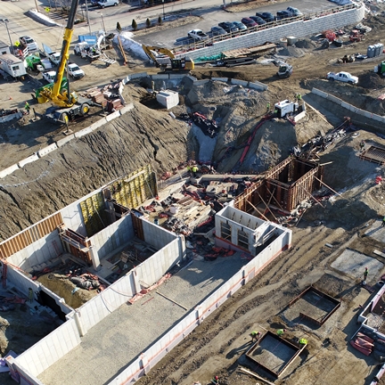
Accurate and up-to-date topographic survey data is key to documenting site conditions before, during, and after construction.
SME’s Low-Altitude Aerial Imaging Services provide a wide array of information to aid in engineering, project documentation, and troubleshooting.
With a fleet of well-equipped, unmanned aircraft system (UAS, or “drone”) platforms, we provide on-call expertise to conduct surveys and inspections from the air.
SME’s FAA-licensed Remote Pilots expertly perform low-altitude flights in accordance with FAA Part 107 regulations. Because responsible operation is SME’s top priority, our unmanned aerial vehicles (UAVs) are registered, well maintained, and fully insured.
Using advanced software, SME technicians process the image data collected by the UAVs to generate a variety of products that benefit client projects.
SME’s low-altitude aerial surveys and inspections produce precise, accurate results, with the added benefit of quick turnaround on projects, typically in a matter of only a few days.